Reality 3D Modeling Software System
Tiki3D Reality 3D Modeling Software Trial
Pioneer and Leader in Photogrammetry
Tiki3D Reality 3D Modeling Software Tutorial
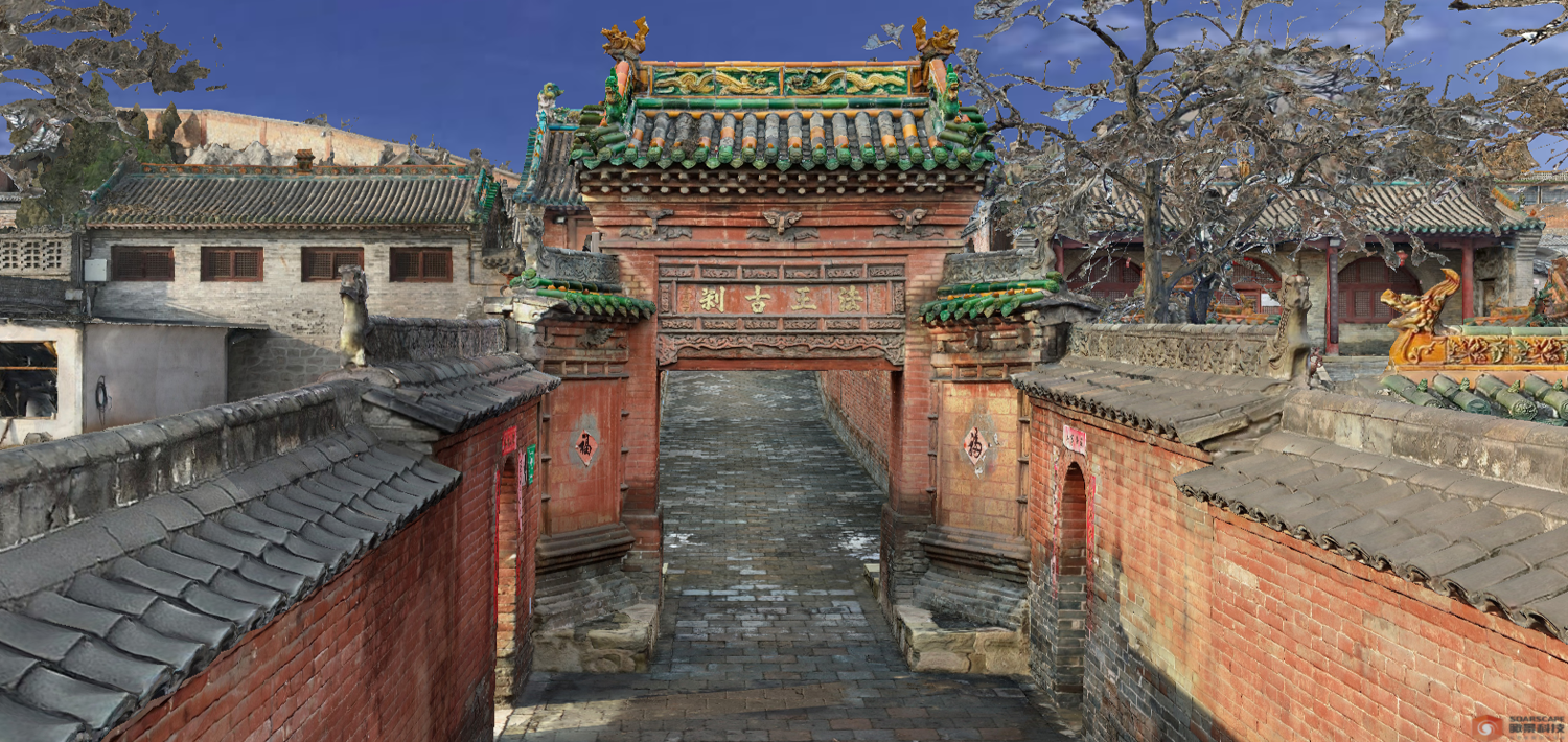
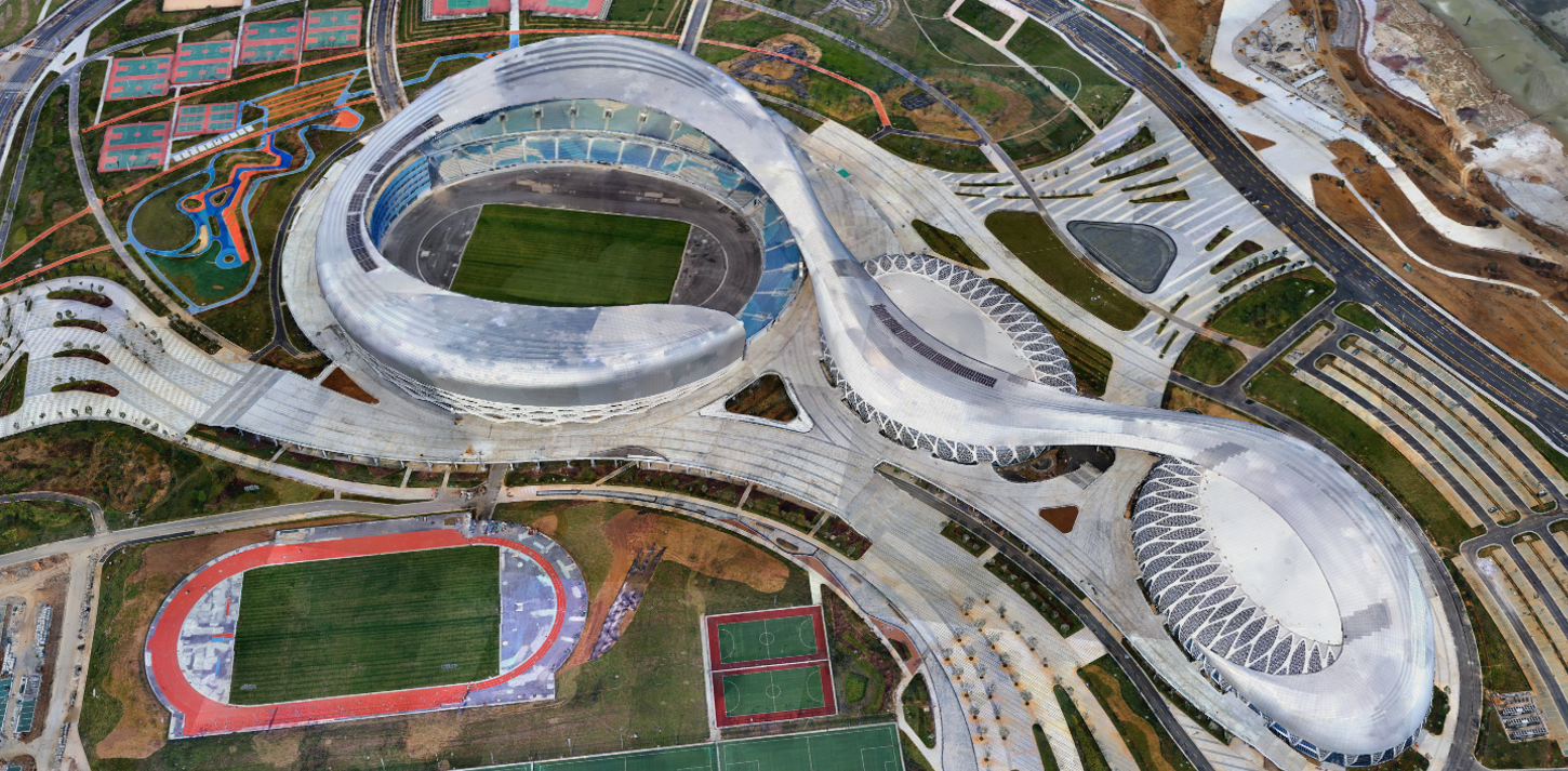
Pioneer and Leader in Reality 3D Modeling Software Systems. The software is user-friendly, easy to learn, and quick to master; it features strong aerotriangulation algorithms to create 3D models at high efficiency. It fully supports a range of image sources, from mobile phone cameras to large 150-megapixel medium-format cameras, and from Low-altitude frame cameras to Satellite Linear Array Pushbroom (LAP) cameras. Built-in rapid 3D model editing tools make it easy to refine damaged areas such as water bodies and road intersections. It features a complete model editing workflow.
The following section contains our software guide, designed to help beginners from zero to hero!
Download, installation, and license activation
Creating your first project
Importing image data
Submitting for aerotriangulation (AT)
Coming Soon
Submitting for Model Reconstruction
Coming Soon
Software Features
User-friendly, strong aerotriangulation algorithms, high versatility, compatibility, and efficiency

Infinite Aerotriangulation Algorithm (ENHANCED)
Newly upgraded “Enhanced Aerotriangulation Adjustment Mode” further increases the data processing capacity for standalone computers, supporting the processing of 100,000 images with 64GB of RAM or 200,000 images with 128GB of RAM. It maximizes hardware utilization in different hardware clustering configurations.
“Aerotriangulation Volume Mode” has been enhanced, increasing the processable data volume limit. This mode supports the processing of over 1 million images with 64GB of RAM. Each stage of the process benefits from cluster parallel computing, employing adaptive partitioning to significantly reduce data redundancy. With automated fusion, you can achieve consistent accuracy in your aerotriangulation results, all while simplifying your workflow with minimal manual intervention.
Infinite Fusion
Our system supports a wide array of multi-source heterogeneous sensors and multi-level resolutions, eliminating the need for geospatial references. It seamlessly integrates both aerial and terrestrial data, whether collected indoors or outdoors, all without requiring any human intervention. Paving the way for a One-Click solution for aerotriangulation and 3D model construction. Additionally, the latest update enhances compatibility and adaptability across various image and laser scanning devices.
Infinite Intelligence
Equipped with a built-in AI deep learning interface, our software automatically performs water surface repairs—recognizing surfaces, filling holes, flattening, and color balancing without requiring manual input. Additionally, our image control feature identifies all control points within your survey area, streamlining the process and enhancing efficiency.
Transform your aerial mapping workflow with Infinite Aerial Triangulation—the ultimate solution for precision and efficiency in the industry.
- The system boasts standalone interfaces and specialized workflows that handle multi-source data automatically, regardless of resolutions, achieving seamless integration of aerial and ground data.
- With 64GB RAM, the system can process over 100,000 photos, and a 128GB RAM configuration can handle over 200,000 images. (The Professional and Flagship editions offer a capacity mode capable of processing over 1 million photos.)
- The automated monomerisation feature supports the export of vector layers for buildings and simplified (.obj) models of monomers for 3D GIS applications.
- Leveraging panoramic target recognition, the system automates the entire aerial triangulation modeling process without the need for manual intervention, ensuring a fully automated process with precision.
- The Advanced Point Cloud & Imagery Fusion module is specifically designed for point cloud data collected from handheld and vehicle-mounted devices. It automatically fuses supplemental ground images, producing high-quality texturized 3D models.
- The system’s database-driven task management ensures stable distribution and higher modeling efficiency, making it ideal for large-scale data processing centers
*The main module’s aerial triangulation capacity mode supports unlimited data volume, which is distinct from the aerial triangulation performance mode in terms of application scenarios. The capacity mode is suitable
for scenarios with uncontrolled settings or insufficient control points, whereas the performance mode is optimized for efficient processing of large partitions.
1 million +
photos (processable)²
∞
Data Volume
∞
Data Fusion
12
Years running


