End-to-End Reality 3D Modeling Solution
Comprehensive One-stop Reality 3D Modeling Solution
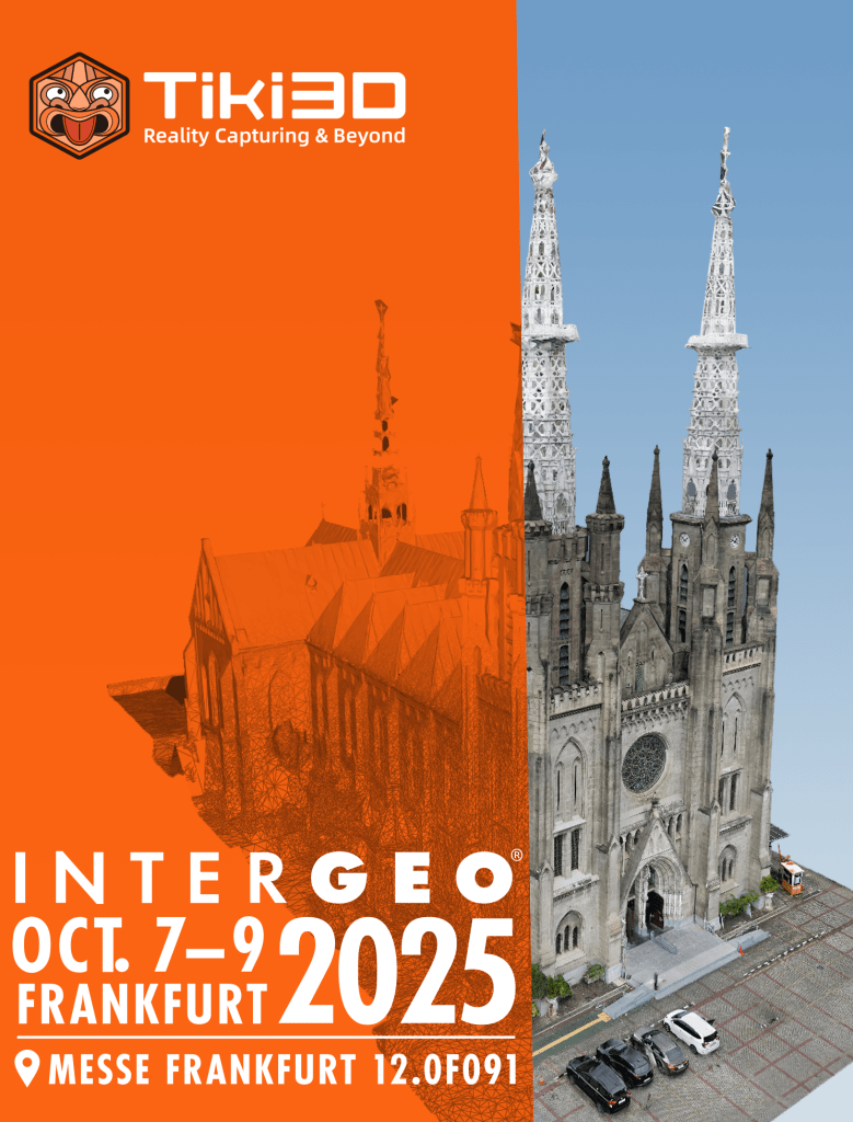
See You in Frankfurt @InterGEO 2025
Connect with us on Linkedin and check out our 2025 eBrochures here!
Tiki3D Reality 3D Modeling Software
Pioneering and leading photogrammetry software for cutting-edge professional 2D/3D mapping and modeling.

Tiki3D Reality 3D Modeling Software
Tiki3D Reality 3D Modeling Software
Tiki3D’s Reality 3D Modeling Software is user-friendly and quick to master. Featuring strong aerotriangulation algorithms to create 3D models at high efficiency. It supports a wide range of image sources and is capable of processing more than 1million images* at any one time. Built-in 3D model editing tools make it easy to refine areas such as water bodies and road intersections.
Tiki LoneHawk Real-time 3D Modeling Solution
Our system enables “On-the-Fly” data transmission and Real-Time processing during drone operations, ensuring high-resolution and accurate outputs. The lightweight 3D model can be viewed in real-time on mobile and VR devices and displayed on remote control room screens.


Tiki3D Satellite
Tiki3D Satellite Image 3D Modelling System can reconstruct multi-view stereo images in 3D and texture map them to create a realistic 3D model.
Highly robust Dense Image Matching algorithms produce denser point cloud. High-precision point cloud fusion algorithm based on image guidance and classification interpolation technology produce highly realistic models that exceeds the level of our competitors.
Tiki3D LiDARPro

Tiki3D LiDARPro is an innovative software designed for automatic construction of 3D geospatial entities using data sources such as point clouds (from Laser scanning, Satellite Remote Sensing, and Dense Matching Aerial Imagery), images (Satellite Remote Sensing and Aerial Imagery), and Mesh models, streamlining the entire process from multi-source data synchronization to point cloud classification, segmentation, and precision validation.
Tiki3D Reality 3D Modeling Software

Infinite Aerotriangulation Algorithm (ENHANCED)
The newly upgraded “Enhanced Aerotriangulation Adjustment Mode” further increases the data processing capacity for standalone computers, supporting the processing of 100,000 images with 64GB of RAM or 200,000 images with 128GB of RAM. It maximizes hardware utilization in different hardware clustering configurations.
Additionally, “Aerotriangulation Volume Mode” has been enhanced, increasing the processable data volume limit. This mode supports the processing of over 1 million images with 64GB of RAM. Each stage of the process benefits from cluster parallel computing, employing adaptive partitioning to significantly reduce data redundancy. With automated fusion, you can achieve consistent accuracy in your aerotriangulation results, all while simplifying your workflow with minimal manual intervention.

Infinite Fusion
Our system supports a wide array of multi-source heterogeneous sensors and multi-level resolutions, eliminating the need for geospatial references. It seamlessly integrates both aerial and terrestrial data, whether collected indoors or outdoors, all without requiring any human intervention. Paving the way for a One-Click solution for aerotriangulation and 3D model construction. Additionally, the latest update enhances compatibility and adaptability across various image and laser scanning devices.

Infinite Intelligence
Equipped with a built-in AI deep learning interface, our software automatically performs water surface repairs—recognizing surfaces, filling holes, flattening, and color balancing without requiring manual input. Additionally, our image control feature identifies all control points within your survey area, streamlining the process and enhancing efficiency.
Transform your aerial mapping workflow with Infinite Aerial Triangulation—the ultimate solution for precision and efficiency in the industry.
Tiki LoneHawk, a system of limitless possibilities, where 3D Models are built Real-Time.
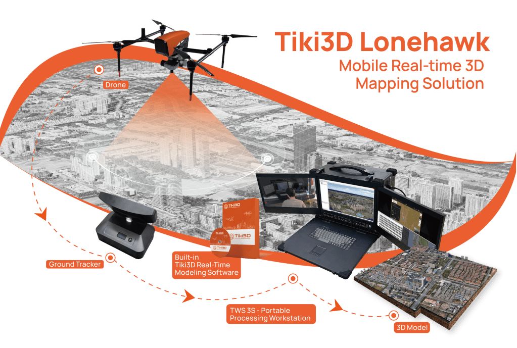
While the drone is in operation, capturing imagery data, the images are transmitted in real-time to the TWS 3S Mobile Workstation, and 2D orthophoto/3D model are generated in parallel
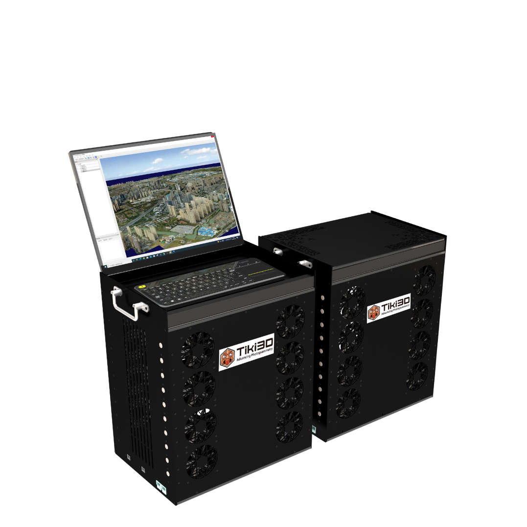
Tiki Processing Hardware
Here’s Tiki3D hardware solution, delivering all the varying computation power you need.


TWS 3S
Designed to be highly portable and versatile with 3 monitor screens.
Outstanding performance in emergency rescue and other field operations, and
nicknamed “Reality Modelling in a Box”.
At 25kg, the size of a suitcase, it is highly suitable for field missions in remote areas.
TWSmini Mobile GPU Workstation
Designed to be highly portable and versatile.
Outstanding performance in emergency rescue and other field operations, and
nicknamed “Reality Modelling in a Box”.
At 25kg, the size of a suitcase, it is highly suitable for field missions in remote areas.


