Tiki3D Satellite
Tiki3D Satellite
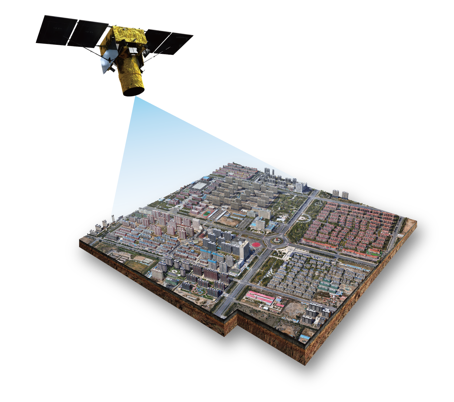
Tiki3D Satellite is a world-leading automatic 3D modeling system for satellite imagery, featuring a fully automated workflow mode and efficient processing capability to produce high-precision satellite realistic 3D models. Using self-developed and highly robust Dense Image Matching algorithms to produce denser Point Clouds with higher accuracy and resolution. Adopting a high-precision Point Cloud Fusion algorithm based on image guidance to achieve building edges that are more refined. Using Classification Interpolation technology to ensure finer terrain models in mountainous areas with high slopes. With accurate structures and natural textures, the overall quality of our models far exceeds the level of our competitors.
Key Features & Advantages
-Supports a rich array of image data sources that are capable of forming stereo pairs, such as SPOT6, SPOT7, GF-7 high-resolution satellites, Pleiades, Kompsat, Worldview1-2-3, etc.;
-Supports a wide-range of output formats such as DSM, DOM, LAS Point Cloud, obj, osgb, and other formats;
-The High-fidelity fusion algorithm ensures the maximum restoration from the image data of ground objects;
-Self-developed and highly robust Dense Image Matching algorithms produce denser Point Clouds with higher accuracy and resolution.
-World-leading satellite imagery modeling technology with straight building edges and realistic building facade textures;
-Simple and efficient data processing: Upon importing of data, real-world 3D models can be constructed on a single click.
-Satellite imagery modeling functions have been integrated into Tiki3D Software’s user-friendly interface, simplifying the learning process.
| Scale of 3D Model | Data Source | Data Output | Tiki3D Product |
| Terrain | High Resolution Satellite Images | Scene: DEM / DSM / TDOM / 3DMesh | Tiki3D Satellite |
| City | Aerial Oblique Images, LiDAR Point Cloud | Scene: DEM / DSM / TDOM / 3DMesh Reality: OBJ / SHP | Tiki3D Modeling Suite (Fusion) Tiki3D LiDARPro |
| Component | Oblique/Close-Range Images, LiDAR Point Cloud | Scene: DEM / DSM / TDOM / 3DMesh Reality: OBJ / SHP | Tiki3D Modeling Suite (Fusion) Tiki3D LiDARPro |
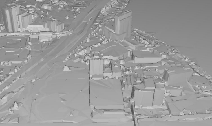
3D Model constructed from
Multi-View Stereo 0.5 Meter Worldview Imagery
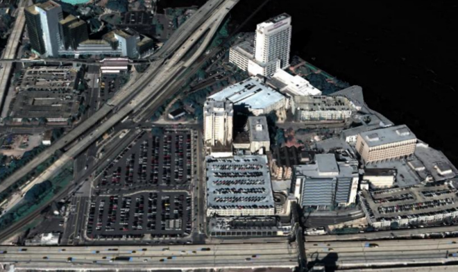
3D White Model constructed from
Multi-View Stereo 0.5 Meter Worldview Imagery