
Tiki3D LiDARPro
Designed for automatic construction of 3D geospatial entities using data sources such as point clouds (from Laser scanning, Satellite Remote Sensing, and Dense Matching Aerial Imagery), images (Satellite Remote Sensing and Aerial Imagery), and Mesh models, streamlining the entire process from multi-source data synchronization to point cloud classification, segmentation, and precision validation.
Tiki3D LiDARPro
-Point Cloud Filtering
-Automatic registration of point clouds with multi-view aerial images
-Automatic classification and semantic labeling of point clouds
-Segmentation of different structures within the point cloud into individual units
-Regular gridding and partitioning of point clouds
-Extraction of planar features from point cloud
-Reconstruction of structured building models based on both point cloud and images
-Modification of model’s structure contours
-Automatic texture mapping and refinement
-Fully automated construction of 3D models (LOD1.x to LOD3.x)
Contact our sales team for a quotation
Unique Features
-Fully Automated 3D Modeling: High efficiency production without need for manual intervention. Capable of automatically constructing 3D segmented structured models and carry out texture mapping, delivering native-resolution models similar to manually drawn ones.
-User-Friendly Interface
-Rapid Integration and display of 3D Point Cloud and 2D Image, and quick extraction of key features.
-Support wide-range of data sources: Various point-cloud data, image data, vector data, and mesh real-scene model data formats.
-Variety of Outputs and Output Formats: Individual models in OBJ format, outlines of structures in SHP format, point cloud classification results, planar segmentation results, feature line results, LOD1.X to LOD3.X models, DOM, etc.
-Support Manual Semantic Labeling for Point Cloud Classification
-Supports an expandable sample library and training models.
-Allows for manual modifications to the 3D models that are automatically constructed from point cloud and images.
-Referential structural modeling of buildings using combined point cloud and imagery data.
-Sketch-based modeling of building structures using multi-view imagery
-Support building vector and point cloud construction of white models at various LOD levels
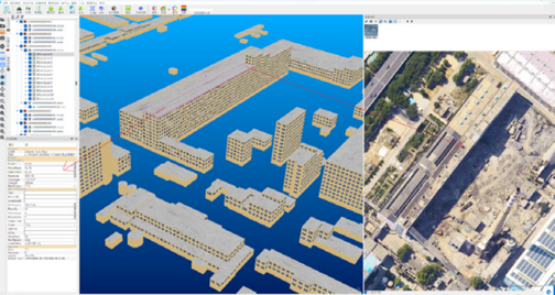
-3D Model and Multi-View imagery integrated editing interface, delivering higher precision models.
-Industry-leading algorithms related to monomerization
-Comprehensive & Functional design: includes data acquisition, editing, texture mapping, and quality inspection
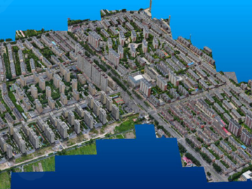
Point Cloud Data from Oblique Imagery
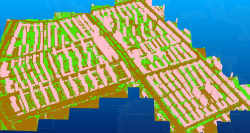
Point Cloud Classification Results

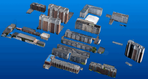
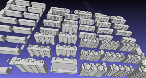
LOD2 Buidling White Models
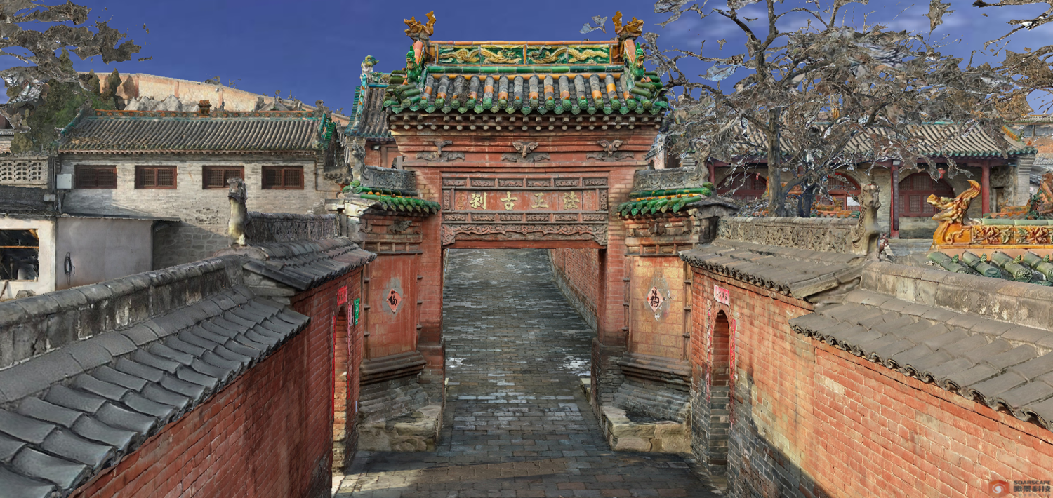
Texture Mapping of 3D Model
Generic Projected Texture
Automatically-extracted Vector White Model
Tiki3D LiDARPro
Contact our sales team for a quote


