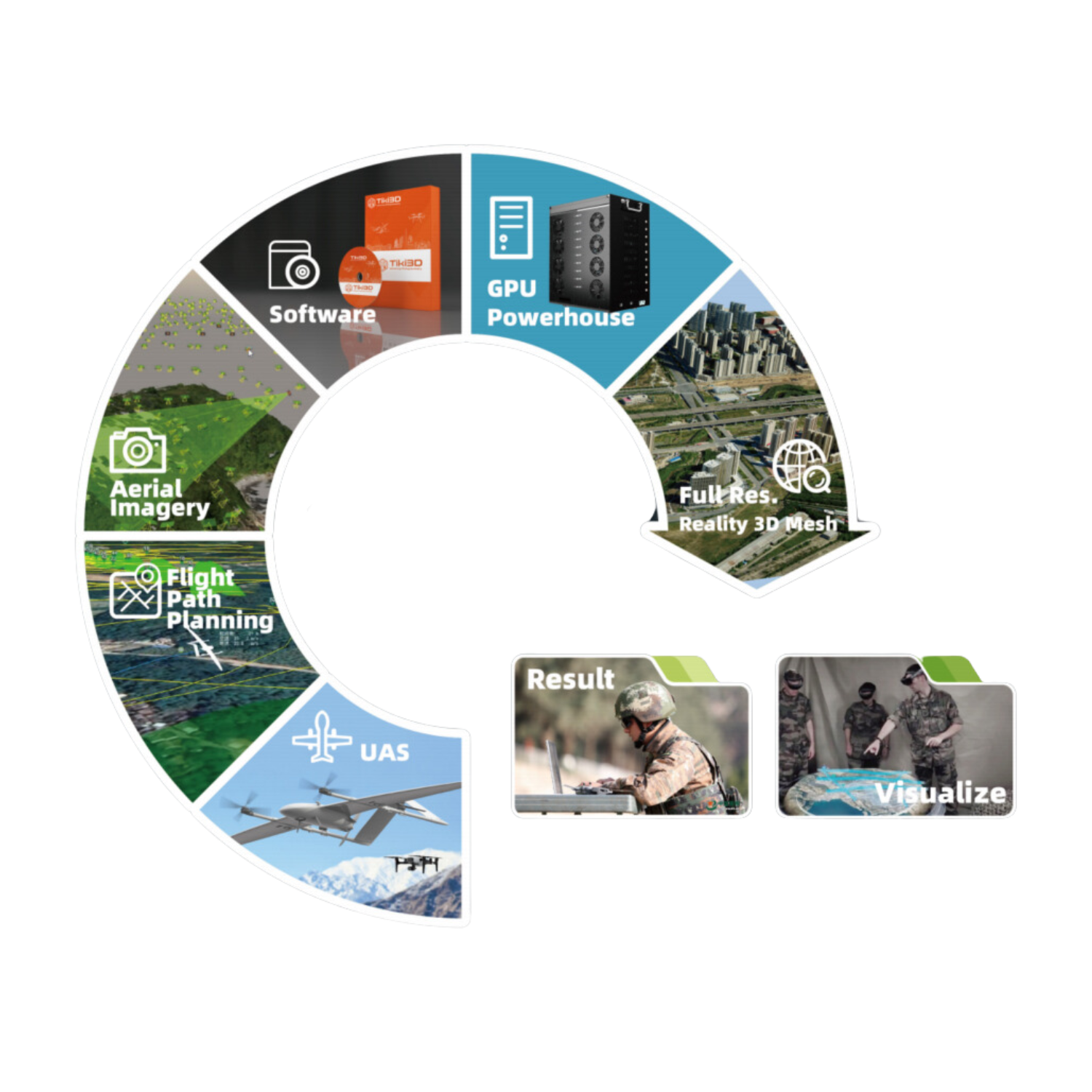
End-to-end 360° Solution

Tiki3D Reality Modeling Software is a fully automated, end-to-end reality 3D modeling solution developed by Tiki Technologies. In addition to our industry-leading Tiki3D Reality Modeling Software, our reality modeling solution includes modules such as Data Acquisition Flight Planning (Smart Flight), Real-Time 2D/3D Modeling, Model Editing (Tiki3D Editor), Model Modification (Tiki3D Advanced Toolkit), and Gaming/Cross-platform Virtual Reality Application (Tiki SmartVerse). These modules integrate data collection, processing, and application into a single system, achieving efficient and high-quality results. This provides users with a one-stop, end-to-end 3D modeling solution.
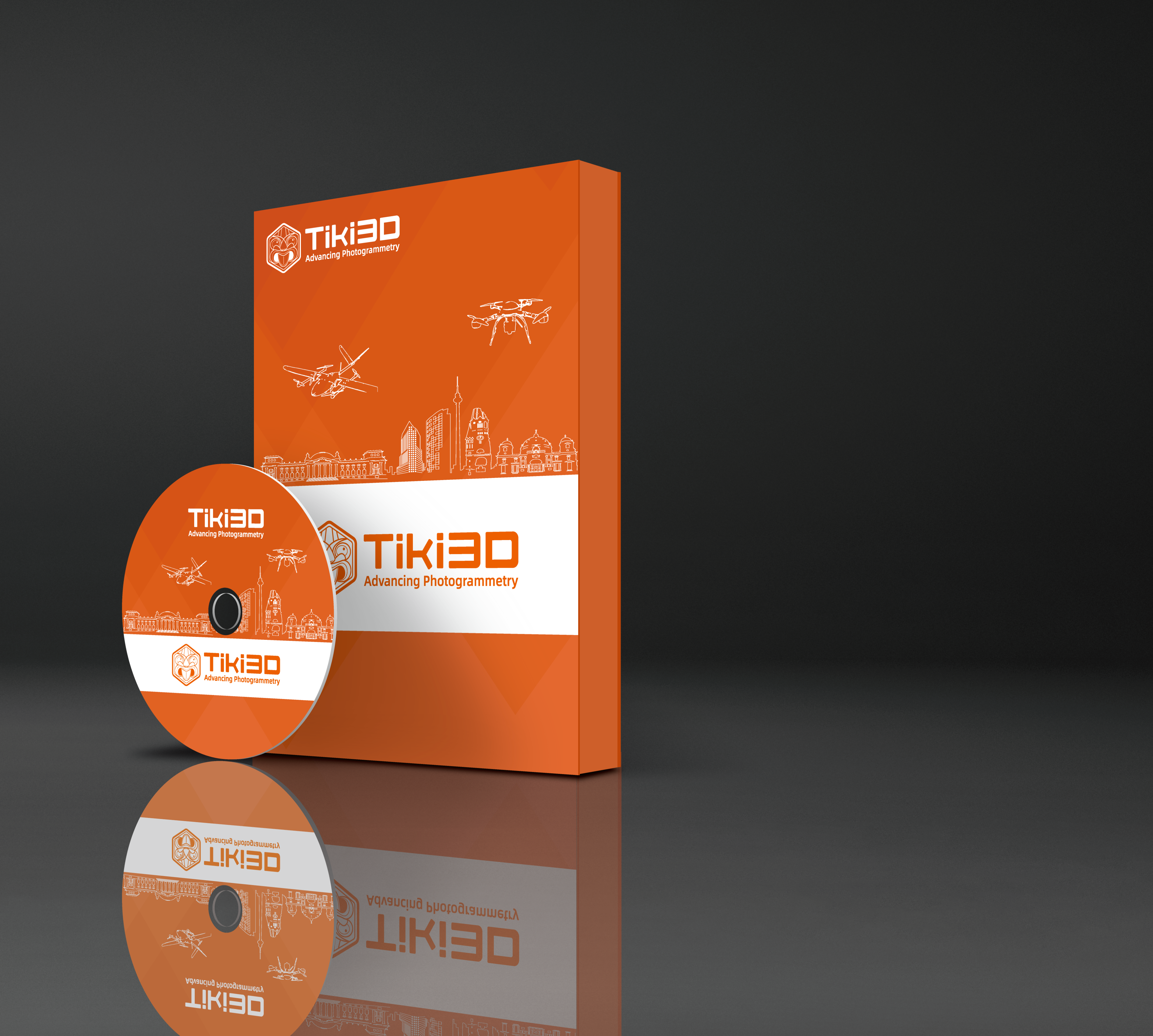
Tiki3D Reality 3D Modeling Software
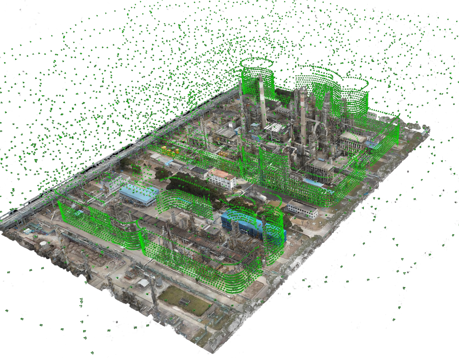
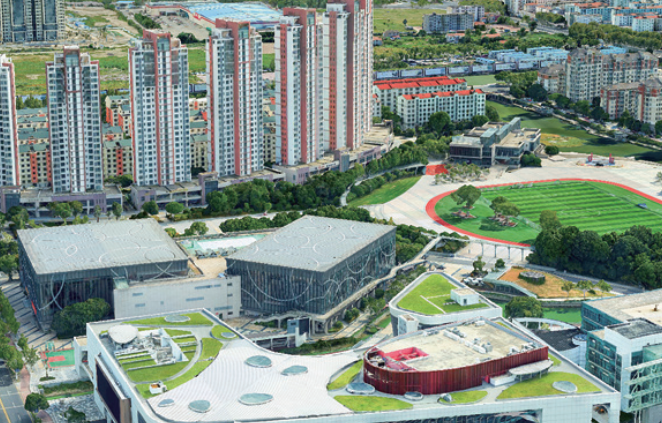
Pioneer and Leader in Real-World 3D Modeling Software Systems. User-friendly, easy to learn, and quick to master; Features strong aerotriangulation algorithms to create 3D models at high efficiency. Supports wide range of image sources, from mobile phone cameras to large 150-megapixel medium-format cameras, and from Low-altitude frame cameras to Satellite Linear Array Pushbroom (LAP) cameras. Built-in rapid 3D model editing tools make it easy to refine damaged areas such as water bodies and road intersections. Complete model editing workflow.
LoneHawk Real-time 3D Mapping Solution
Designed to streamline workflow with an “On-the-Fly” capability, where data can be transmitted while drones are still in operation, allowing for immediate data processing.
This Real-time transmission & computation process does not compromise on resolution, guaranteeing a high-fidelity, accurate output. Generated lightweight 3D model can be browsed in real-time by multiple users on various mobile and virtual reality devices, and can projected onto big screens remotely.
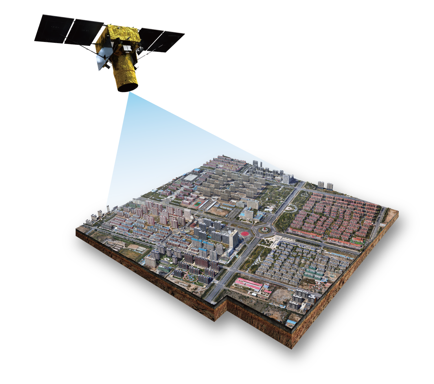
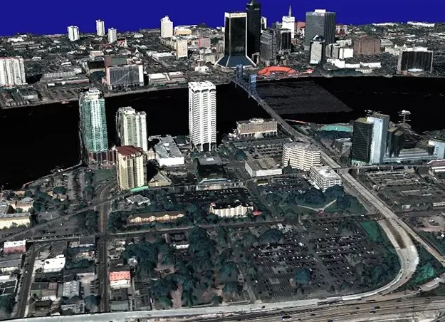
Tiki3D Satellite
World-leading automatic 3D modeling system for satellite imagery, featuring a fully automated workflow mode and efficient processing capability to produce high-precision satellite realistic 3D models. Self-developed and highly robust Dense Image Matching algorithms produce denser Point Clouds with higher accuracy and resolution. High-precision Point Cloud Fusion algorithm based on image guidance to achieve building edges that are more refined. Classification Interpolation technology ensures finer terrain models in mountainous areas with high slopes. With accurate structures and natural textures, the overall quality of our models far exceeds the level of our competitors.
Tiki3D LiDARPro
Tiki3D LiDARPro is an innovative software designed for automatic construction of 3D geospatial entities using data sources such as point clouds (from Laser scanning, Satellite Remote Sensing, and Dense Matching Aerial Imagery), images (Satellite Remote Sensing and Aerial Imagery), and Mesh models, streamlining the entire process from multi-source data synchronization to point cloud classification, segmentation, and precision validation.
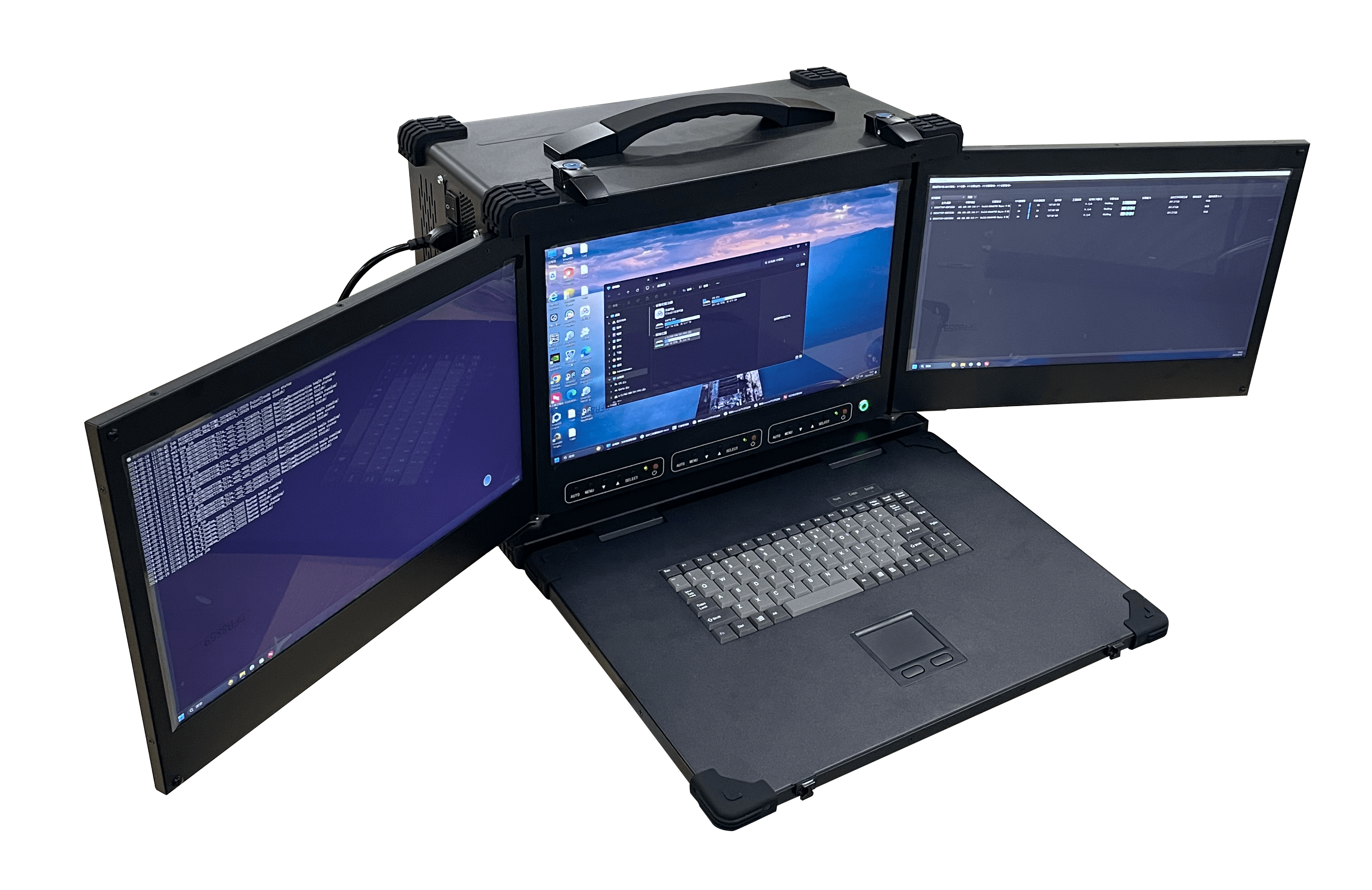
TWS Mobile GPU Workstation
Designed to be highly portable and versatile. Outstanding performance in emergency rescue and other field operations, nicknamed “Reality Modelling in a Box”. At 25kg, the size of a suitcase, it is suitable for field missions in remote areas. Able to construct 3D models real-time, in the field.
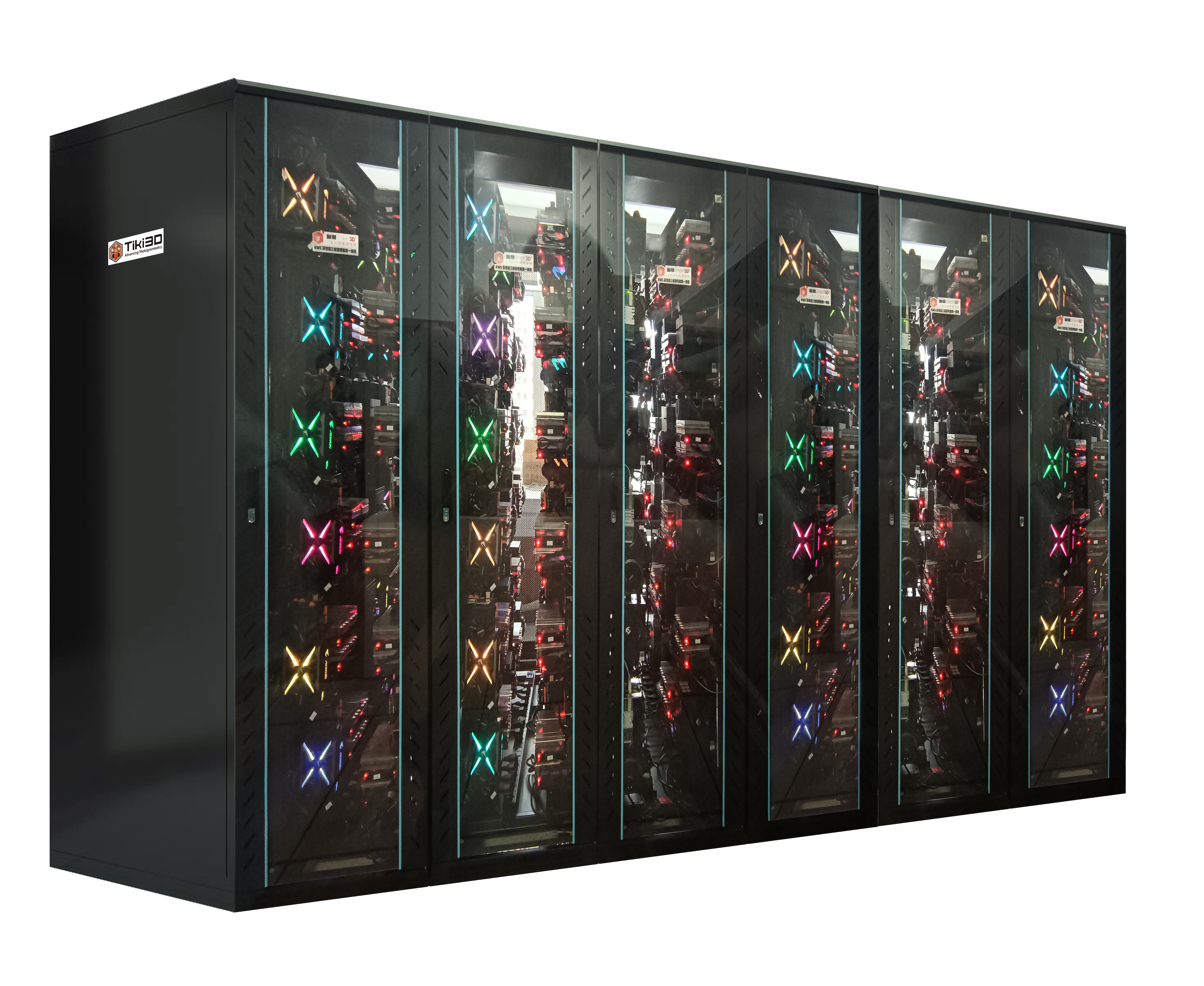
TWS High-Density GPU Server
Designed for high performance, large-scale projects that require scalable, massive computation power. Our cluster server is fully customisable based on your project and needs.
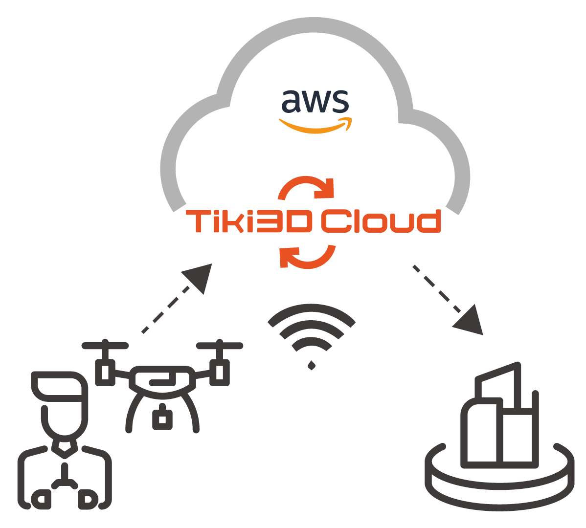
Tiki3D Cloud
Cutting-edge cloud-based solution designed for seamless aerial image processing. With Tiki3D Cloud, users can effortlessly capture aerial images using their drones and upload them directly to our AWS cloud for processing.This innovative platform leverages advanced algorithms to deliver high-quality 3D reconstructions, perfect for a variety of applications ranging from mapping and surveying to construction and urban planning.
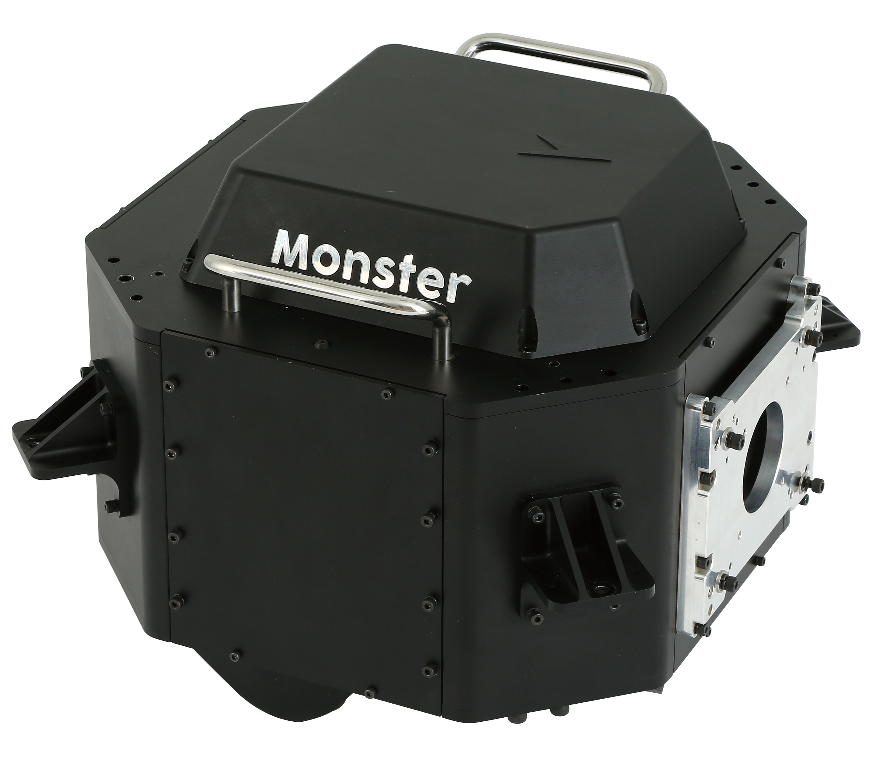
Little-Monster Oblique Camera System
A oblique aerial photography system independently developed by Tiki Technologies. The system consists of five 100-megapixel Phase One industrial cameras, which capture textures of buildings, rooftops and facades from different angles. The system is reinforced, calibrated for precision, and equipped with a High Precision GPS aerial antenna, NovAtel/S1 high-precision inertial altitude measurement system, and an aerial photography management computer. The system also integrates software for flight path design, flight control, and data post-processing. Our lightweight camera can be installed on a variety of aerial vehicles.
Tiki3D Reality 3D Modeling Software

Infinite Aerotriangulation Algorithm
Newly upgraded “Enhanced Aerotriangulation Adjustment Mode” further increases the data processing capacity for standalone computers, supporting the processing of 100,000 images with 64GB of RAM or 200,000 images with 128GB of RAM. It maximizes hardware utilization in different hardware clustering configurations.
“Aerotriangulation Volume Mode” has been enhanced, increasing the processable data volume limit. This mode supports the processing of over 1 million images with 64GB of RAM. Each stage of the process benefits from cluster parallel computing, employing adaptive partitioning to significantly reduce data redundancy. With automated fusion, you can achieve consistent accuracy in your aerotriangulation results, all while simplifying your workflow with minimal manual intervention.
Infinite Fusion
Our system supports a wide array of multi-source heterogeneous sensors and multi-level resolutions, eliminating the need for geospatial references. It seamlessly integrates both aerial and terrestrial data, whether collected indoors or outdoors, all without requiring any human intervention. Paving the way for a One-Click solution for aerotriangulation and 3D model construction. Additionally, the latest update enhances compatibility and adaptability across various image and laser scanning devices.
Infinite Intelligence
Equipped with a built-in AI deep learning interface, our software automatically performs water surface repairs—recognizing surfaces, filling holes, flattening, and color balancing without requiring manual input. Additionally, our image control feature identifies all control points within your survey area, streamlining the process and enhancing efficiency.
Transform your aerial mapping workflow with Infinite Aerial Triangulation—the ultimate solution for precision and efficiency in the industry.
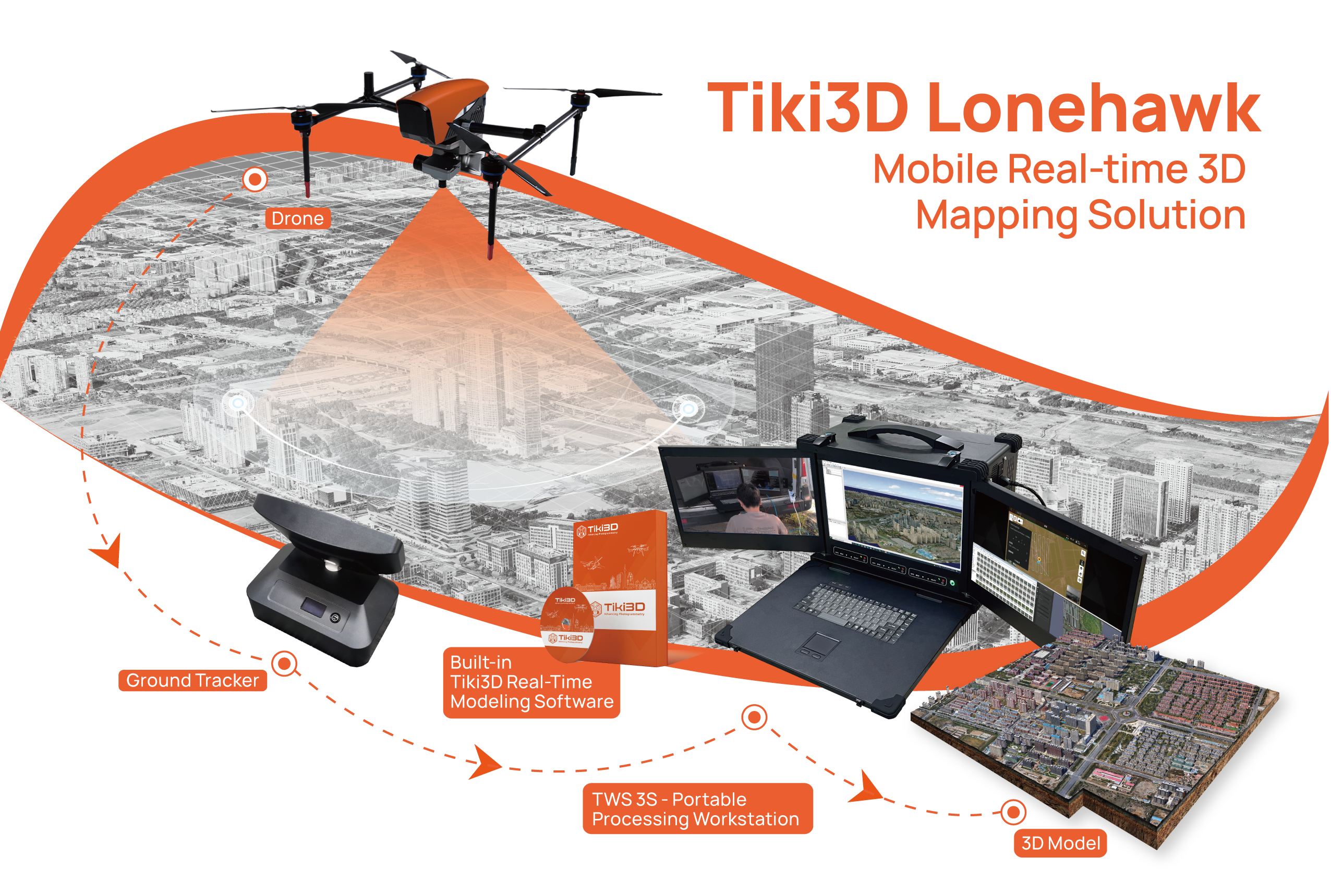
Discover a world of possibilities with Lonehawk Real-Time 3D Modeling
Designed to streamline workflow with an “On-the-Fly” capability, where data can be transmitted while drones are still in operation, allowing for immediate data processing. This Real-Time transmission and computation process ensures that there is no loss in resolution, guaranteeing high fidelity in the final output. The result is crystal-clear, high-definition deliverables, produced without any compromise on accuracy or quality. The generated lightweight 3D model can be browsed in real-time by multiple users on various mobile and virtual reality devices, and it can easily be pushed to big screens in control rooms thousands of miles away.
